
Applications of OA Science
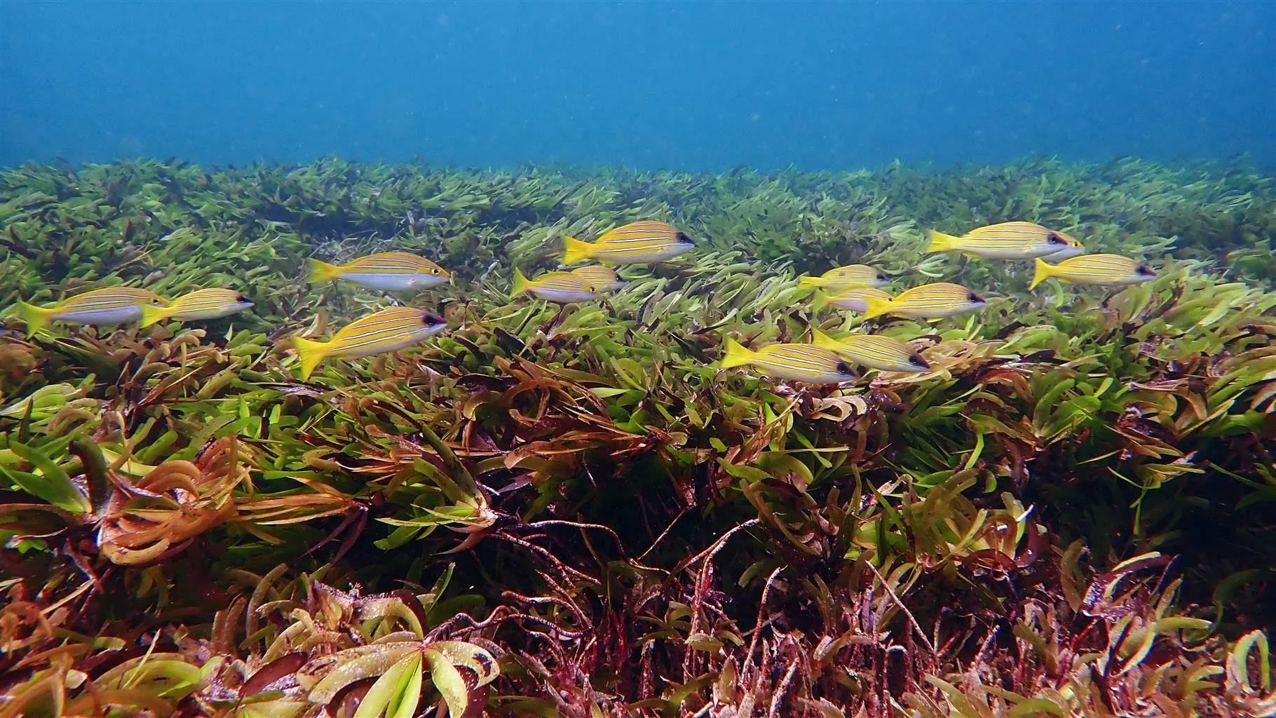
Seychelles Seagrass Mapping and Carbon Assessment
In its latest Nationally Determined Contribution (NDC) to the Paris Agreement 2015, the Republic of Seychelles committed to preserving 100% of the nation’s seagrass meadows by 2030, toward including blue carbon ecosystems in its national greenhouse gas inventory. In order for Seychelles to claim a nature-based solution as a mitigation component of its nationally determined efforts, the country must be able to measure how this solution is supporting carbon sequestration efforts and outline strategies for ongoing management of the ecosystem.
This project responds to the needs of the government to gather spatial data on the distribution of seagrass meadows and to validate their potential to sequester carbon. To this end, an inventory of seagrass meadows in Seychelles Exclusive Economic Zone (EEZ) was conducted using best practices for blue carbon determinations. This critical research aims to provide the government with accurate sequestration rates (tCO2e/yr) to inform the development of the NDC and national policies for management of these critical habitats. As partners prepare to map seagrass across the Western Indian Ocean, this project serves as an example of long-term research that promotes a science-to-policy loop for harnessing the remarkable value of seagrass to nature, coastal communities, and the blue economy.
Dr. Jérôme Harlay of the University of Seychelles reflects that this project really benefited from a conjunction of events that happened at just the right time. “Sometimes the stars align, but other times you have to trigger this kind of alignment yourself. Any project of national amplitude depends on government willingness to engage. The first step is to show your government how your project is relevant for national communications, protocols, or conventions related to the environment.” Dr Harlay encourages researchers and institutions to become familiar with national policy, like their NDCs. Developing a basic understanding of the relevant policy landscape can help researchers and community partners envision feasible pathways within existing frameworks. “In order for the project to have a national impact, you have to direct it into national policy.”
Logistics
-
Numerous community partners and NGOs
-
Fieldwork began in 2019. When the pandemic emerged, the project gained a year of bonus time to refine the best protocols. Developing a complete dataset with regional goals for carbon sequestration assessment took another 1.5 years. Currently, consultants are developing recommendations to produce a blue carbon policy that fills the policy gaps in effective protection and conservation of seagrass assets. The future of this project involves monitoring seagrass health in marine protected areas and determining socioeconomic value in the region.
-
Satellite seagrass detection was associated with a field component to ground-truth geospatial information using camera imagery, large dataset processing tools, sediment cores, and coastal punctual CTD deployments. Researchers from around the globe contributed to sediment dating, organic matter analysis, remote sensing, and engine processing for image analysis. Additionally, a unique social science effort was required to address local needs for lexical innovation.
-
TBD
-
pH
total dissolved inorganic carbon (DIC)
total alkalinity (TA)
partial pressure of carbon dioxide (pCO2)
calcium ion
-
TBD
Objectives
The Seychelles Seagrass Mapping and Carbon Assessment Project was initiated to deliver the seagrass components of the Seychelles most recent Nationally Determined Contribution (NDC) commitment by: assessing the distribution and extent of seagrass habitats, quantifying how much carbon is stored in associated below-ground sediments, assessing the rate at which carbon accumulates, and building scientific capacity to support future surveys and a blueprint for further development of seagrass mapping and blue carbon research regionally.
Within its Nationally Determined Contribution (NDC), the nation of Seychelles has committed to mapping the full extent of the blue carbon seagrass and mangrove ecosystems within its waters and measuring their carbon stock values, with the goal of including these ecosystems within the Seychelles’ National Green House Gas inventory.
Challenges
-
A main constraint of this project was the lack of local technical expertise to conduct fieldwork in blue carbon. The majority of on-island expertise was in conservation. PEW Charitable Trusts responded to this constraint by assembling a small cohort of local experts and filling knowledge gaps by bringing in international experts in geospatial science, policy, etc. Future endeavors may need to employ a similar tactic, as talent retention in small island nations is an ongoing challenge.
-
The project design allocates responsibility for data sharing to the Government of Seychelles, whose GIS department is responsible for maintaining the maps produced by this project. Currently, interested parties must send a written request to the department and process the shared files with their own software; visualization needs improvement. Project coordinators are aware that public accessibility of data produced by this effort is not optimal. International partners are in the process of developing open-source data sharing options, but data embargoes continue to limit progress in this area.
-
Most of the seagrass in Seychelles is not in the nearshore areas, where drivers of ocean acidification and other degradation can be more directly managed. Most of the country’s seagrasses are in the periphery of the offshore plateau or widely distributed in the outer islands, where accessibility is difficult and law enforcement cannot control activity restrictions. Of the seagrass habitat that is accessible, very little is offered Zone 1 High Biodiversity Protection by the country’s marine spatial planning policies. There is much work to be done toward community self management and protection.
-
As changes in political leadership occur over time, questions arise regarding each administration's priorities. Project coordinators hope increased global visibility of this project will act as an incentive for future government administrations to continue supporting the project and its outcomes. One advantage of a small island nation is increased access to the president and ministers; many of this project’s contributors have been able to speak with government officials directly throughout this process. As of 2026, the current president has personally toured many of the project’s ground-truthing sites and is familiar with the instrumentation used in data collection. As a result of these interpersonal experiences, the current government feels connected to this project. It is imperative that project coordinators engage incoming administrations in a similar manner, to ensure the legacy and longevity of these efforts.